Strathearn Cycling map

£6.95
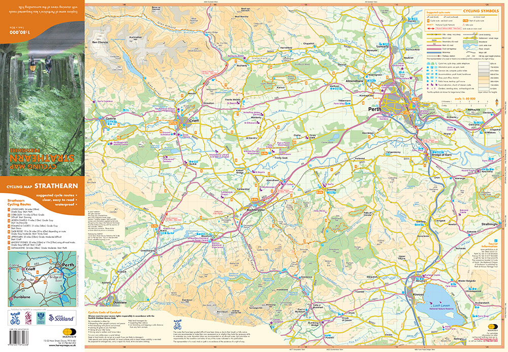
Scale 1:80,000 Shows the network of minor roads and includes 8 suggested cycle routes. Click here to view the map coverage Made in cooperation with ByCycle and Perth and Kinross Council and Perth and Kinross Countryside Trust Steep hills are marked; also the location of cycle shops and cycle hire. Shows the general topography including layer-coloured high ground, forest, rivers, lochs settlement. General information includes location and phone numbers for the Tourist Information Centres. Points of interest, services and facilities, toilets etc. are marked. Map size 700x485mm folded to 116x242mm Printed on waterproof paper.
Orders placed and accepted before 12pm Monday – Friday will be dispatched the same day. Orders placed after 12pm are dispatched the next business day.
To UK addresses:
Standard Royal Mail 48 Tracked shipping is FREE for ALL orders over £20. For orders less than £20, delivery charge for Royal Mail 48 Tracked is £2.50. If you require a faster shipping service please select Royal Mail 24 Tracked at checkout.
EU, USA and Rest of the World:
Orders are dispatched by Royal Mail International Tracked service.
Prices start at £7.95 to EU countries, £13.95 to the USA and £8.95 to all other countries.
For full delivery and returns information view our Terms and Conditions page