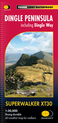
Dingle Peninsula including Dingle Way

£15.50
The whole of the Dingle Peninsula on one lightweight, waterproof map at the popular 1:30,000 scale. Includes Mount Brandon and the entire Brandon Group of mountains in the west of the Peninsula. To the east, the Slieve Mish mountains are also shown. The map also shows the Dingle Way – a 179km long distance walking route around the edge of the Peninsula that starts and finishes in Tralee. The route is highlighted in red. The Blasket Islands are also shown at 1:50,000 scale. Popular for day trips, these uninhabited islands are the most westerly point of Europe. Placenames in English and Gaeilge / Gaelic. Archaeological sites and walls and fences in farmland are clearly marked. Click here to view map coverage Tough, light, durable and 100% waterproof
Genuine, original, HARVEY mapping
Opens directly to either side of the sheet
Easy to re-fold For more information on the Superwalker click here
Orders placed and accepted before 12pm Monday – Friday will be dispatched the same day. Orders placed after 12pm are dispatched the next business day.
To UK addresses:
Standard Royal Mail 48 Tracked shipping is FREE for ALL orders over £20. For orders less than £20, delivery charge for Royal Mail 48 Tracked is £2.50. If you require a faster shipping service please select Royal Mail 24 Tracked at checkout.
EU, USA and Rest of the World:
Orders are dispatched by Royal Mail International Tracked service.
Prices start at £7.95 to EU countries, £13.95 to the USA and £8.95 to all other countries.
For full delivery and returns information view our Terms and Conditions page