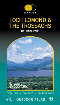
Loch Lomond & The Trossachs
£9.95
Mapping of the whole of Scotland’s first National Park in one handy book. When you get to the edge of the map, just turn the page! Click here to view atlas coverage Spiral bound to lie flat in the hand Waterproof for outdoor use. Though not tearproof, the atlas pages are printed on latex impregnated paper, making them waterproof. If your Outdoor Atlas gets wet, just hang it up to drip-dry! The detailed mapping at scale 1:40,000 is suitable for walkers and cyclists and other outdoor enthusiasts, and is a useful reference for residents and visitors. The book is a handy size (14x24cm) for carrying in a mapcase, map pocket or bike map holder. 96 pages Includes the National Grid and can be used with GPS.
Orders placed and accepted before 12pm Monday – Friday will be dispatched the same day. Orders placed after 12pm are dispatched the next business day.
To UK addresses:
Standard Royal Mail 48 Tracked shipping is FREE for ALL orders over £20. For orders less than £20, delivery charge for Royal Mail 48 Tracked is £2.50. If you require a faster shipping service please select Royal Mail 24 Tracked at checkout.
EU, USA and Rest of the World:
Orders are dispatched by Royal Mail International Tracked service.
Prices start at £7.95 to EU countries, £13.95 to the USA and £8.95 to all other countries.
For full delivery and returns information view our Terms and Conditions page