
Here at HARVEY HQ, we are often asked what it is like to be a part of the team that carries out the survey work and field checking for our award winning maps. People enthuse that it must be fantastic to be paid to go hillwalking – and of course this is true, but it is only half the story!
The most recent survey trip was around Pitlochry in Perthshire, Scotland, to check the newly created mapping for an upcoming Superwalker XT25 map. The team talk about their highlights below.
Lewis
What a difference 8 months makes. My last survey trip was to Galloway last October for a few days. Surveys in October are always wet and that trip was no exception. On this latest survey however, the weather was fantastic and made for a great couple of days walking around Pitlochry. 20 degrees and sunny. Perfect!
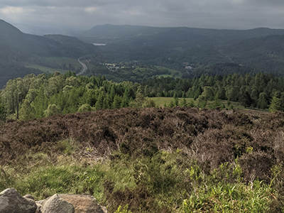
A survey highlight for me was climbing the small hill of Craig Fonvuick. At only 413 metres high, this is a really accessible hill that boasts amazing views over Pitlochry and Ben Vrackie. As part of the survey, the team walk the Core Paths in the area. Core Paths are a network of paths that give the public reasonable access through an area. Lots of these paths are hidden gems and provide quiet walks.
The area around Pitlochry is a perfect base to sample some of Scotland’s best landscape. Lochs for swimming, forests for mountain biking and, of course, Munros for bagging. If you’re new to Scotland, I’d recommend this area (and of course this map). There is something for all levels of experience.
Holly
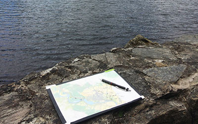
When we head out on a survey trip we print paper copies of our new map, attach them to a board, and place a sheet of tracing paper over the top to record any changes or additions we find along the way. This may seem pretty low tech (it is), but it is still the best way of gathering the data we need.
Take our survey of Peddars Way, for example. I decided to use this trip to test out a new digital mapping app I hadn’t used before. Unfortunately, the trip was in November, and my phone has a nasty habit of turning itself off if it gets too cold, so a few hours into the survey, my phone was completely unusable.
More recently I headed up to Pitlochry with a GPS unit to record my route. Despite leaving the unit charging for all of the previous day, halfway through my walk I noticed the battery had died. Not to worry, I thought, I have a spare. I switched the batteries over and sure enough: that one died too. Don’t get me wrong, there is some great tech out there for navigation, but nothing can beat a paper map.
Return to the News & Features Blog